
Day 1:
We set off from Karlu Karlu down through Wauchope and Wycliffe Well to get onto the dirt. To get a feel of the “real NT”. After checking in at Wauchope Pub as the book suggests before going onto the Binns Track (much to the surprise of the owner), and finding that the only aliens around were the ones belonging to us…we were ready for some red dirt.

A quick visit to Ali-Curung to visit an artist, May Wilson, who we own one of her paintings back at home (we found out that she lives here when we visited the cultural centre in Tennant Creek).
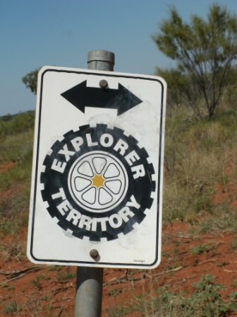
We then wove our way through to find the Binns Track to go up (north) to the Davenport Ranges.

Tree covered sandy track, rocky river crossings, narrow and windy, flooded creek beds with flowers in bloom and Spinifex in flower. Brilliant. We didn’t see a soul.

We only managed to make it 80 km in 3 hour before we got to a crossing too wide, too deep for travelling alone with a trailer on a track less travelled.


We were not making it to Old Policeman’s Waterhole this year. We turned around and found a flat enough place on Spinifex (looks soft – is very spiky) and set up camp. Peace and serenity.
Day 2: Pink sunrise with birds and flowers – we are now wary of pink sky in the morning. We continued back down the Binns south. We picked up a black fella, Anthony, standing under a tree in the middle of nowhere and took him to his community, Ampilatwatja, who were hosting the “local” footy that coming week. It would be for all of the Indigenous communities in about 800km radius. The road in was being graded in preparation. Big celebrations were going to be held that week.


At the Sandover “Highway” (it really is just sand-over-a-highway) corner, there were millions of zebra finches feasting on the seeds at the rest stop. Middle of nowhere and a rest stop.


Every moment we stopped there was a different wildflower that presented itself.

Turning off the Sandover, the track became “4WD” and there were more water crossings, really long, sandy and wide river crossing, steep rocky hills, sharp deep creek crossings, big jump up (that came from nowhere), narrow and windy track, overgrown and washouts like we have never seen before. Northern Territory means 4WD when it says it. We had to reshape some of the washouts so that Nansy, our truck, could make it with Trusty, our trailer to follow. No problems.


One river was so wide that it had 2 islands in the middle, and when we finally got to the other side, there was a tree across the track (where is that chainsaw…).


A long and slow day. Damages amounted to: one water jerry – smashed, trailer socket – cracked, trailer wire – broken off, pole holder lid – lost. This is the most damage that we have ever incurred in one day! Lots of driving and looking at the fields of flowers; thinking about how the colours of Australia should be purple, white, yellow, green and grey/green.
We finally made it to a place where we could stop, Dneiper Station at the Box Hole Crater (not Box Hill) at 5.30pm, sunset, exhausted. We bush camped on the track near the crater to the sound of pitter patter of the rain.

Day 3:
Despite much looking (and no signage), no actual sighting of the crater was made. It may have had to do with the incredibly overgrown, lush vegetation. Even from the top of the rocky hill it wasn’t visible. On our way out we chatted to Alan, Station Manager, who said that it wasn’t much anyway and was hard to see because all the trees are so lush and overgrown. He has grown up here and says that this is the best is has ever been in the last 38 years. How lucky are we!?


The road was better from here to the Plenty Highway, although visible that someone had done it pretty hard in the wet and there were still some big wet and muddy patches.

On the Plenty we called into Atitjere for fuel and local advice about the Cattlepass Track (shorter way to East MacDonnell Ranges). “Yeah, beautiful view from the top, should be right on the other side.” Enough for us.
Lunch at the turn off, meeting fossickers looking for garnets – at which the boys immediately found loads of specks. Onwards to the 4WD only road.


Rocky, jump ups, water crossings, views, flowers, creeks, washouts that were the whole track, views that were priceless, and the drive long and slow. Worth it? You bet!!
Insanely beautiful. Three and a half hours to drive 63 km if that says anything – and that is without stopping, just good, slow and careful driving. We only saw one group of other cars on this track.


Heavy clouds were coming from the west and we were anxious to cross the Hale as we know that rivers here rise quickly and high and it would be impassable for us. The campground listed at Artlunga is long closed, Ruby Gap was closed (as we found when we drove around and around – due to flooding), so it was Old Ambalindum Homestead. We made it in time to set up, make tea, shower – then it rained for 20 hours.

Day 4:
Rain at Old Ambalindum, East MacDonnell Ranges. Bob and Lois Carpenter, Station Managers, were kind enough to let us use the Cowshed as we went from singlet and shorts every day to thermals. Rain, rain, rain. Flooding. Wood fired stove meant bread, popped corn and soup, warmth and shelter. Definitely worse places to be. We were very thankful.


Day 5:
The wind came up and began to dry up the rain. The Hale was flowing – no road out and it was freezing. The boys had a go at cracking a whip with Tim, the Station Owner, and helping with the horses. Emily, his wife, made us marshmallow. A walk to the lake blew away the cobwebs amongst the flocks of budgeries.


We watched the puddles dry up.
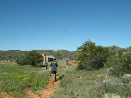
Day 6: A look around the ruins of Artlunga (old gold mining town) was very interesting. We found that there was still no way into Ruby Gap. Closed, closed, closed. The back road out of the station will allow us out tomorrow and creek crossings are not too deep now for us. Off to Trephina Gorge.


No comments:
Post a Comment